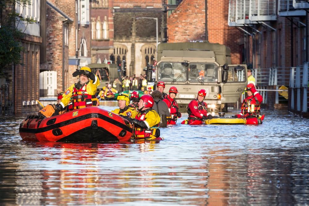
As Storm Imogen hits south-west England and south and mid-Wales, 13,000 homes are left without any power. In fact, the Environment Agency has nearly sixty flood warnings in place and more than 170 flood alerts.
These storms are occurring more frequently with Storm Henry hitting recently and in early December, Storm Desmond had a devastating impact on Cumbria and Lancashire, with more than 43,000 homes suffering from power cuts, an estimated 5,200 homes affected by flooding and caused untold damage to properties and transport infrastructure.
With this in mind, the question arises as to what organisations can do to mitigate the damage inflicted by these increasingly prevalent natural catastrophes.
> See also: How to bring disaster recovery to the board: a guide to addressing each member of the c-suite
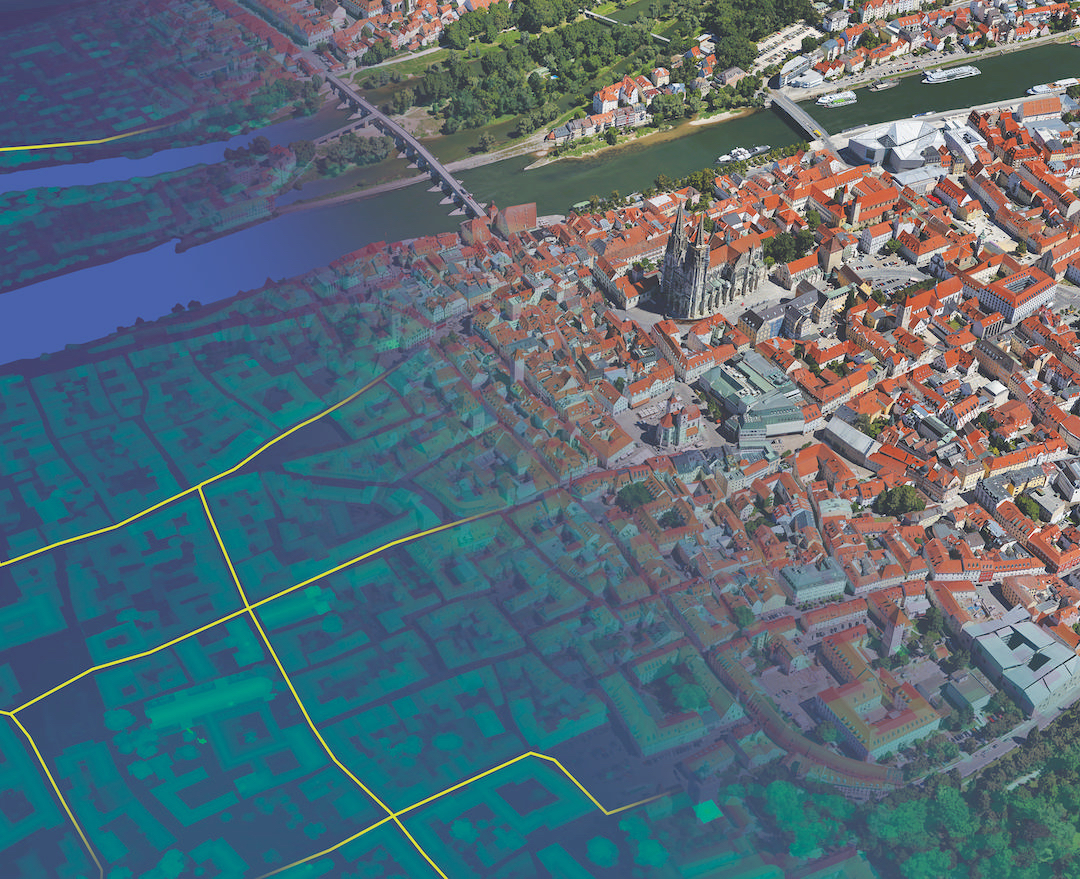
The way that emergency services, housing associations and property insurers use GIS (Geographic Information Systems) mapping and analytics to plan ahead, manage risk and respond proactively to severe weather events, can be a lesson to the wider business community.
Interactive maps are able to provide real-time geospatial information throughout the entire development of the weather system; from tracking the path; to identifying where and when it’s going to hit; aiding disaster response and evacuation.
GIS mapping can play a vital role in emergency services’ evacuation planning. North Wales Police use GIS to provide a live, real-time view of emergency situations. Used in conjunction with general mapping of the area, location of units and live feedback from mobile devices, emergency services are able to execute safe and efficient evacuation protocols swiftly.
Housing associations also make good use of GIS technology to pre-emptively put in place anti-flooding measures around susceptible areas, minimising future damage and the associated costs.
Moreover, housing associations are able to assess locations for potential new housing developments according to whether the new area is at risk of flooding in the future.
GIS mapping also plays a vital role in disaster response. Insurance companies can access a wealth of information about a specific geographic area, and implement a protocol that needs to be followed in the event of a disaster.
For example, if a severe weather event is due to hit a specific area, GIS mapping could be used to locate policy holders, showing the individual value of each insured property, as displayed in this insurance risk damage demo.
Using this data, they could identify concentrations of at-risk policy holders via a heat map. This would allow the insurer to inform all at-risk policy holders to help protect their family and property.
Not only would the insurance company reduce claims and minimise damage done to property, but it is simultaneously providing excellent customer service.
Market leading property insurers RSA, Direct Line Group and Aviva all use GIS in this way to respond promptly to claims and weed out fraudulent ones. They are also able to price policies competitively and more fairly based on the precise location, as opposed to postcode area for example.
That precise location can be intersected with data such as flood plains, physical hazards, geopolitical risk and historic claims in order to assess the overall risk of a property. Insurers can even decide not to insure a property if their overall exposure to flood events or other risks in the area where that property is located would then be too high.
When devastating floods swept across central Europe in 2013, Esri UK worked with international insurance broker Willis Group Holdings to gain detailed, real-time insight into the disaster as it happened. Willis was then able to provide well informed advice to its increasingly fraught customers and strengthen its reputation as an expert in flood risk and mitigation.
The ramifications of a natural disaster can be endless. Land Rover had serious issues with its supply chain back in 2011 when its paint supplier in Japan was affected by the earthquake. This meant that it was unable to deliver cars on time, due to it not being able to get hold of the specific paint pigment it needed.
Now, supply chains span the globe and are exposed to many environmental, geopolitical, economic, and other risks. Avoiding disruptions is critical to meeting customer demands and avoiding the scenario outlined above.
> See also: The central intelligence atlas: how BI is going visual
Using GIS for supply chain management can assist in optimising distribution networks and facility locations, balance inventories based on demand or events, and react to unexpected disruptions quickly and effectively.
Enterprise GIS is increasingly an integral part of catastrophe planning, making disaster response proactive rather than purely reactive. Visualising an area and applying spatial analysis with GIS enables risk to be more accurately assessed, informs the advanced planning and identification of preventative measures, enhances emergency management and facilitates faster recovery.
The increasing frequency and prevalence of these natural catastrophes in the UK cannot be ignored. Rather than just a timely response, proactive measures need to be put in place to truly mitigate the potential damage that can be inflicted.
Whether it’s to strategically plan for building developments, or ensure safe and efficient evacuation of civilians in the event of a catastrophe – GIS has a key role to play.