The use of unmanned aerial vehicles (UAVs, or “drones” as they are often called) has really taken off in the last couple of years as businesses devise more and more innovative ways in which they can be used to improve service and efficiency.
The environment and ecology sectors are no different, and using UAVs to help survey large areas quickly and provide a bird’s eye view of the landscape below is shaking up the industry and improving the way in which some of the traditional and time-consuming work is now done.
>See also: A transport revolution: the drone passenger carrier
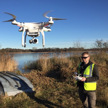
A specialist team at ecology consultancy, Thomson Ecology, has been doing exciting work in the ecology sector as they use UAVs to look at how they can benefit business efficiency and create more useful in-depth information for clients. They are appropriately qualified and certified to use UAVs commercially and work alongside ecologists on site helping to map large areas of terrain and topography for ecology purposes.
The team recently worked with Essex & Suffolk Water using UAVs on an exciting and innovative project which mapped 269 hectares of land across Norfolk, including Trinity Broad, from above and gave Essex & Suffolk Water data which they could share with their whole team and use for future comparisons of habitat changes.

The team at Thomson Ecology has combined this UAV technology with their own bespoke interactive mapping system, TIM (Thomson Interactive Mapping), which allows the high resolution UAV imagery to be overlaid with habitat mapping, allowing clients to track habitat changes over a period of time.
>See also: How to solve the danger of the drone
UAV-based surveys, such as those carried out for Essex & Suffolk Water, involve a lot of planning with steps that need to be followed to ensure the safe and successful acquisition of data, whether it is still imagery, film or other information. A flight plan must be put together and checks done on the area to be surveyed to check it is not in restricted airspace. All relevant permissions must be sought in advance and weather forecasts checked to ensure flying conditions are suitable. Once those preparatory steps have been taken, work can start.
The work at Trinity Broad for Essex & Suffolk Water took place in mid-winter so the team had to watch carefully for a suitable weather window before they could fly. After a final review of the site to check for any flying constraints missed during remote mapping of the area, the flight plan was finalised, the flight team briefed and the survey was able to start.

This particular flight mainly consisted of identifying the areas to be flown and establishing an appropriate flight height, speed and pattern. Autonomous systems within the UAV dealt with a lot of the flight handling and control, while the pilot and other members of the flight team monitored the progress of the flight and kept a close watch for any potential incursions into the flight area both on the ground and in the air.
>See also: Drone technologies establish evolved GIS
The Trinity Broads survey area was large so the team repeated their flight plan many times over the course of a week. An extra complication arose from the occasional need to launch and land the UAV from a boat when surveying large areas of water.
With the surveys completed and the captured imagery safely stored on the company servers, just over four and a half thousand individual aerial images were merged into a single, geo-referenced image suitable for mapping and habitat identification.
With the aerial imagery processed and merged into the large-scale images, the final step was to produce habitat maps. For this particular survey, the habitat mapping was primarily focused on a section of the Broad rather than the whole site.
To a large extent, the habitat mapping was undertaken using manual identification and digitisation directly from the aerial imagery, though where possible and appropriate, image recognition software and automated processes were employed to speed things up.
>See also: Autonomous drones in the oil and gas industry
Trinity Broads project is a good example of how UAVs can be deployed to do work that would otherwise have taken weeks of painstaking ground surveys by ecologists on foot. By harnessing UAV technology, the team were able to focus their expertise on more strategic work, save weeks of time and therefore cost to the client, and use the technology to create clear aerial images.
This provided Essex &Suffolk Water with clear data, allowing them to monitor parts of the site remotely for habitat change. This is a technology that Thomson Ecology is now employing on many of its projects, and it is revolutionising older, standard working practices in the industry.
Sourced by Ross Johnson, bid manager at Thomson Ecology